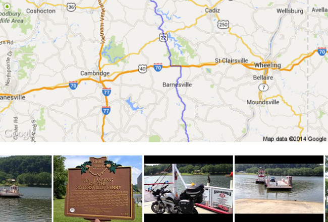
One fact about the eastern Ohio landscape is that the terrain gets more varied and the roads more fun the further south you go. This is thanks to the way the glaciers of the Laurentide Ice Sheet carved the land up about 18,000 years ago.
One of the great ways to explore this geographical transition from the flatter lands of northeast Ohio to the Appalachian hills of the southeast is through Ohio State Route 800. Read More
Southern Ohio has a lot of great roads for those looking for a challenge, several of which are referred to as “Ohio’s Tail of the Dragon”. I like to think of Ohio State Route 78 as the “Backbone of the Ohio Dragons” because it connects to several of these roads while rolling through some spectacular countryside riding. Read More
The arrival of Memorial Day means that many will be looking forward to warm-weather road trips. Long gone are the days of hard-to-fold paper maps or asking for directions at sketchy gas stations in small town America.
For this week’s Tech Tuesday segment on WTAM 1100’s Wills & Snyder in the Morning, we had a chance to talk about a number of smartphone and tablet apps for road trips that can not only help you get where you are going, but entertain you on the way and help find you a place to stay along the way.
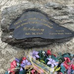
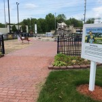
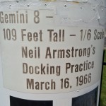
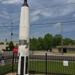
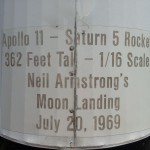
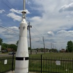
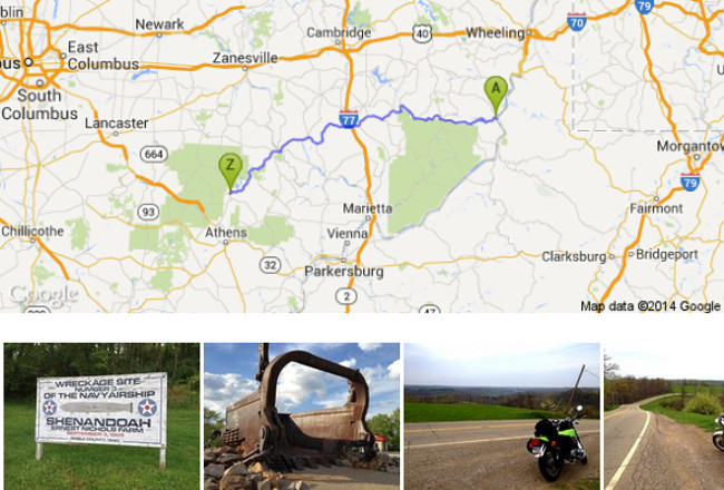
Did you know that Warren, Ohio is home to a half-scale replica of the Apollo 11 Lunar Module? One thing I love about a ride through the countryside are the small attractions you pass along the side of the road.
This Warren, Ohio park marks the area where six-year-old Neil Armstrong took his first airplane flight. In July 20, 1969, the Apollo 11 Lunar Module landed on the moon with Astronaut Neil Armstrong becoming the first man to walk on the moon.
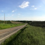
If you live in Northeast Ohio, you have to ride a bit to get to the more interesting roads. One of these would be Ohio State Route 164, which winds its way through 45 miles of twists, turns, hilltops and valleys.
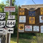
The route starts in Leesville, Ohio, passing through the tiny countryside towns of Amsterdam, Bergholz, Salineville and finally ending in Lisbon, Ohio.
The road surface along the way varies from areas that were freshly paved a year or two ago, to areas that are still decent, but have some patching along the edges. Gravel isn’t a concern through most of the route, except for a few tricky curves where a gravel road empties onto the road near an apex.
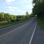
The route has examples of every type of riding challenge you could want, from long sweepers to extremely tight corners with rapid camber changes. What really increases those challenges is the number of hilltops and blind curves that hide what’s coming next until you’re nearly on top of it.
For much of the ride, it almost becomes a repetitive game, where the smart rider rolls off the throttle near the top of the many hills, allowing them a small bit of time to see the next quarter-mile ahead and plan their lines accordingly. Then it’s down the hill like a roller-coaster, dodging and twisting until the peak of that next hill and a new layout.
Speeds vary from 25mph in the few small towns you’ll pass through to 45 and 55 mph areas. The surprises this road throws at you make it very important not to outrun your sight lines, and the yellow speed warning signs ahead of curves are actually good recommendations to follow for many. If you see a 25 or 15mph yellow sign ahead, SLOW DOWN! The curve is more likely to be a 90 degree corner.
However, don’t be surprised to see one of every type of bike on the road during peak time, including cruisers, sports bikes, tourers and adventure kits.
For riders looking to keep things safe, I would recommend starting from the Leesville side and going north to Lisbon, versus the other way around. Most of the more technical challenges tend to be close to Leesville, and the curve warning signs are often missing for the first 10 miles. Best to take that challenge while you’re fresh on the rider and save the mellower (and far better marked) part for later.
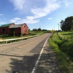
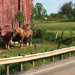
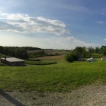
Along both sides of the road, you’ll encounter a number of family farms, complete with cows, horses and other livestock lazily watching the light road traffic pass by.
The many changes in elevation along the route will take you from being surrounded by trees on either side, to winding ridge tops that allow you to see the rolling countryside for miles.
While the countryside makes for a great view, it does mean there are few accommodations along the way. If you think you might need to stop for some water, food or just to use the restroom, do it as soon as you get the chance, don’t wait and hope for another change later in the route.
Also keep in mind that mobile phone coverage is spotty at best, and often completely non-existent. Pre-download map data if your smartphone GPS app of choice allows it. 45 miles may not seem like a lot, but there is a fair amount of time between those very (very) tiny little towns and traffic can be light along the route.
For those in the northeast Ohio area, Route 164 presents a great opportunity to get some twists, turns, swoops and dips into their lives within a (mostly) reasonable driving distance!?

 The arrival of Memorial Day means that many will be looking forward to warm-weather road trips. Long gone are the days of hard-to-fold paper maps or asking for directions at sketchy gas stations in small town America.